Your Land Registry title plan is one of the most important documents you own as a property owner in England and Wales. My Boundary Dispute Surveyors regularly help clients understand these crucial documents, and we've seen countless boundary disputes arise simply because property owners didn't properly interpret their title plans. This guide will teach you everything you need to know about reading and understanding your HM Land Registry property documentation.
What is a Land Registry Title Plan?
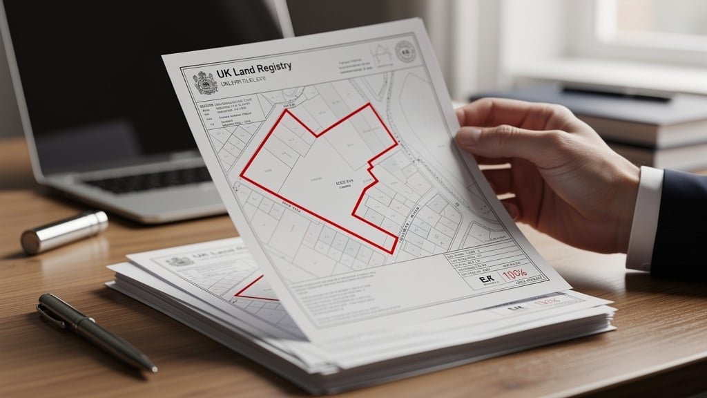
A title plan is an official document produced by HM Land Registry that shows the general extent and position of your property. It's based on Ordnance Survey mapping and is one of three documents that make up your property's registered title, alongside the register document and any filed documents referenced in the register.
The title plan typically shows your property boundaries marked with a red line, though properties can also be marked in different colours if there are multiple titles shown on the same plan. The plan is designed to give a general indication of where your property is located, but crucially - and this is where many property owners get confused - it does NOT show exact boundary lines.
The General Boundaries Rule
The most important concept to understand when reading your title plan is the general boundaries rule. Under this rule, which applies to virtually all registered properties in England and Wales, the boundaries shown on your title plan indicate only the general position of the boundary - not its exact location.
This isn't a mistake or oversight. The Land Registry deliberately adopts this approach because:
- Title plans are based on Ordnance Survey maps with limited scale precision
- The red boundary line on the plan is typically 0.5mm or thicker, representing several meters on the ground
- Exact boundary positions would require detailed measured surveys for every property
- Historic property records rarely contained precise boundary measurements
- Most property transactions proceed smoothly without exact boundary definition
This means that if your fence, wall, or hedge is a meter or two away from the red line on your title plan, this doesn't necessarily indicate a problem. The physical boundary on the ground may be correct even if it doesn't precisely match the plan.

Key Elements of Your Title Plan
The Red Line Boundary
The most prominent feature on most title plans is the red line that shows your property extent. This line runs around the perimeter of your property, and the area inside it is the land included in your title. However, remember the general boundaries rule - this shows approximate position only.
Title Number
Every registered property has a unique title number shown on the title plan. This alphanumeric code typically consists of two or three letters followed by a series of numbers. The letters usually relate to the geographical area where the property is located. You'll need this title number when ordering official copies of your title or making applications to Land Registry.
Ordnance Survey Grid References
The title plan shows Ordnance Survey grid references to help locate the property. These appear as numbers along the edges of the plan and provide precise geographic coordinates based on the National Grid reference system.
Scale
The scale of the plan varies depending on the size and location of your property. Common scales include:
- 1:1250 scale for urban properties (1mm on the plan = 1.25 meters on the ground)
- 1:2500 scale for suburban and rural properties (1mm = 2.5 meters)
- 1:10000 scale for very large rural estates (1mm = 10 meters)
The larger the second number, the less detail you can expect to see. This is another reason why boundary disputes occur - at 1:2500 scale, a 1mm thick line represents a 2.5 meter band on the ground, making precise boundaries impossible to determine from the plan alone.
Coloured Edging and Tinting
Beyond the main red line boundary, you may see other coloured markings on your title plan:
- Green tinting - shows areas where you have certain rights (like access rights) over land that isn't part of your title
- Brown tinting - indicates areas where third parties have rights over your land (like a right of way)
- Blue edging - shows property boundaries that are defined by water features (foreshore, river banks, etc.)
- Other colours - may be used to distinguish between different titles shown on the same plan
T-Marks and H-Marks
T-marks are small "T" shapes that appear along boundaries on some title plans. These indicate which property owner is responsible for maintaining that boundary feature (fence, wall, or hedge). The "T" points toward the property with maintenance responsibility.
An H-mark (two T-marks facing each other across the boundary) indicates joint responsibility for boundary maintenance. However, not all title plans include T-marks or H-marks, and their absence doesn't necessarily mean anything about maintenance responsibility.
Measurements
Some title plans include measurements showing the length of certain boundaries or dimensions of the property. When these appear, they should be treated as approximate rather than exact figures, unless the property has a determined boundary (see below).

Reading the Title Register Alongside the Plan
Your title plan should always be read in conjunction with your title register document. The register is divided into three sections:
Property Register
This section describes the property and may include important information about boundaries, such as:
- Notes referring to specific boundary features shown on the title plan
- References to filed plans that may show more detail than the main title plan
- Descriptions of rights of way or access that affect boundary interpretation
- Any special boundary notes or exceptions
Proprietorship Register
This section shows who owns the property and may include restrictions that affect what you can do with boundary features. For example, some titles have restrictions preventing the removal of boundary walls or hedges without consent.
Charges Register
This section details any rights or restrictions that affect your property, which may be relevant to boundaries:
- Easements and rights of way that cross your land
- Restrictive covenants affecting boundary features (like requirements to maintain fences)
- Access rights that give others the right to cross your boundary
Common Title Plan Markings and Symbols
Understanding the symbols and markings on your title plan is essential for proper interpretation:
Property Features
The Ordnance Survey base map shows various property features that help identify your land:
- Buildings are shown as outlined rectangles or shapes
- Walls, fences, and hedges may be shown as lines (though not always)
- Roads are typically shown in yellow or light brown
- Gardens and open land appear as white or tinted areas
- Trees may be shown as small circles or symbols in larger rural plots
Labels and Notes
Various labels may appear on your title plan:
- "For identification only not to scale" - a standard disclaimer
- Arrows or notes referring to specific parts of the register
- Date stamps showing when the plan was issued or updated
- Notes about determined boundaries (rare but important)
What Title Plans Don't Show
It's equally important to understand what your title plan does NOT show:
Exact Boundary Positions
As we've emphasized, unless you have a determined boundary (which will be clearly noted on the plan and register), the title plan does NOT show the exact position of your boundary line. This is the single most misunderstood aspect of title plans and the cause of many property disputes.
Underground Features
Title plans don't typically show underground features like:
- Pipes, cables, and utility lines
- Drains and sewers
- Underground boundary markers (though these may be mentioned in the register)
- Foundations or sub-surface structures
Some Boundary Features
The OS mapping used for title plans may not show all boundary features on the ground:
- Recently erected fences or walls
- Small boundary markers or posts
- Some hedges, especially if they're narrow
- Temporary or moveable boundary features
When to Order Updated Title Plans
You should consider ordering an updated copy of your title plan when:
- You're planning building work near your boundaries
- A boundary dispute arises with your neighbour
- You're buying or selling your property
- You want to check if any changes have been registered since your last copy
- Your current copy is more than a few years old
You can order official copies of your title documents directly from the Land Registry website for a small fee (currently £3 for digital copies). Make sure to order both the title register and title plan together, as they should always be read as a set.

When You Need Professional Help
While many property owners can understand the basics of their title plan, certain situations require professional assistance from a qualified boundary surveyor:
Boundary Disputes
If you're in dispute with your neighbour about where the boundary lies, a boundary survey by an experienced land surveyor can establish the most likely position of the legal boundary by analyzing:
- Your title plan and register
- Your neighbour's title documents
- Historic Ordnance Survey maps
- Old conveyance deeds and transfer documents
- Physical features on the ground
- Measurements and survey evidence
Determined Boundaries
If you need to establish the exact legal position of your boundary, you can apply to HM Land Registry for a determined boundary. This process requires:
- A detailed survey by a qualified land surveyor
- A precise plan showing the exact boundary position
- Supporting evidence for the proposed boundary line
- Formal application to Land Registry
- Notice to adjoining owners who can object
Once a determined boundary is approved and registered, it becomes part of your title and shows the exact legal boundary position. This is shown on your title plan with a special marking and explanatory note.
Complex Title Plans
Some title plans are complex and difficult to interpret without professional help:
- Properties with multiple title numbers
- Split-level properties where different floors have different ownership
- Properties with complex access arrangements
- Rural properties with extensive or irregular boundaries
- Properties near public highways or waterways
Comparing Your Title Plan to the Ground
When comparing your title plan to what you see on the ground, follow these steps:
- Note the scale - Remember that at 1:1250 scale, even 1mm on the plan represents 1.25 meters
- Identify fixed features - Look for buildings, roads, and other permanent features that appear on both the plan and the ground
- Orient the plan correctly - Most OS maps have North at the top, but check the grid references to be sure
- Allow for generality - Remember the general boundaries rule and don't expect exact alignment
- Check both sides - Look at your neighbour's boundaries as well as your own
Common Misconceptions About Title Plans
Let's address some common myths about Land Registry title plans:
Myth 1: "The Red Line Shows Exactly Where My Boundary Is"
False. The red line shows the general position only. Your actual legal boundary might be several meters either side of the red line, depending on the scale and circumstances.
Myth 2: "If My Fence Doesn't Match the Red Line, It's Wrong"
Not necessarily. The fence position may be correct, and the red line may simply be showing a general position. You'd need to investigate further to know for certain.
Myth 3: "T-Marks Prove Ownership of the Boundary"
T-marks show maintenance responsibility, not ownership. The boundary itself is jointly owned by both neighbouring properties regardless of who maintains it.
Myth 4: "The Title Plan is a Measured Survey"
No. A title plan is based on Ordnance Survey mapping, not on a measured survey of your specific property. Only a determined boundary incorporates precise survey measurements.
Using Your Title Plan for Property Transactions
When buying or selling property, understanding your title plan is crucial:
Before Purchasing
Before completing a property purchase:
- Obtain and review the title plan during the conveyancing process
- Walk the boundaries and compare them to the plan
- Note any discrepancies or concerns
- Raise questions with the seller through your solicitor
- Consider commissioning a boundary survey if you have concerns
When Selling
As a seller, being prepared about your boundaries helps smooth the transaction:
- Have current copies of your title documents ready
- Be prepared to answer questions about boundary positions
- Disclose any boundary disputes or uncertainties
- Gather any evidence about boundary positions (photos, surveys, correspondence)
Digital Title Plans
Modern Land Registry title plans are available digitally, offering some advantages:
- Instant availability through the Land Registry portal
- Lower cost than postal copies (£3 vs. £7)
- Ability to zoom in for closer inspection
- Easy sharing with surveyors, solicitors, and other professionals
- Digital archiving for your records
Digital plans are legally equivalent to paper copies and are accepted for all official purposes.
Conclusion
Understanding how to read your Land Registry title plan is an essential skill for every property owner in England and Wales. The most important lesson is to remember the general boundaries rule - your title plan shows approximate boundary positions, not exact measurements. When disputes arise or exact boundaries are needed, professional help from a qualified boundary surveyor can provide the detailed analysis and evidence necessary to resolve uncertainty.
At My Boundary Dispute Surveyors, we regularly help property owners interpret their title plans and resolve boundary questions. Our experienced land surveyors can analyze your title documents, conduct detailed site surveys, and provide expert reports that clarify boundary positions. Whether you're facing a boundary dispute, planning building work, or simply want to understand your property boundaries better, we're here to help.
Need Help Understanding Your Title Plan?
Our experienced land surveyors can help you interpret your Land Registry title plan and resolve any boundary questions. We provide detailed analysis and expert advice to help you understand your property boundaries with confidence.
Frequently Asked Questions
How accurate are Land Registry title plans?
Title plans show general boundaries only, with accuracy depending on the scale. At 1:1250 scale (common for urban properties), precision is within 1-2 meters. For exact boundaries, you need a determined boundary application.
Can I rely on measurements shown on my title plan?
Measurements on title plans are approximate unless the property has a determined boundary. They should be treated as general guides rather than exact figures.
What if my fence doesn't match the red line on my title plan?
This is common and doesn't automatically indicate a problem. Due to the general boundaries rule, small discrepancies are normal. If you're concerned, consult a boundary surveyor.
How do I get a determined boundary on my title plan?
You must apply to Land Registry with a detailed survey plan and supporting evidence. The application requires notice to adjoining owners and Land Registry approval. A professional boundary surveyor can assist with this process.
Do all title plans show T-marks?
No. T-marks appear only on some title plans. Their absence doesn't mean anything definitive about boundary maintenance responsibility.